Sugarloaf Mountain – Nothing Sweet Here, Just COLD SWEAT!

I actually started writing this quite a while ago and never finished.  2018 has not been a hiking year for me.   It has been a running year as I have been dedicating myself to doing the 2018 Marine Corps Marathon in D.C.  The mountain is seemingly calling me and not to do a measly 4-5 mile hike in the Hudson Valley, I need a gruesome, blood sweat and tears hike in the Catskills, the Adirondacks or The Whites.  I think next week I will venture into the whites to redo some of those trails.

In sum here is what I wrote a while ago,. no modification just what I found in this draft.  Excuse typos and errors, I will not correct this draft:

“Hiking is a difficult venture.  You go out and play a game against an imposing mountain.  The mountain says, I am too difficult for you young one, go hike a hill, or a nice flat park.  I am mountain, you are weak, turn around now!  So it would be safe to say then that hiking a mountain in winter is doubly as hard.  Part of what hiking gives me is that peace with nature, that battle against the imposing behemoth.  It’s David and Goliath, every bagged peak is a won battle against a never ending ridge.

This hike I did under a sheet of ice with a friend.  Ever since I took him on my last mental health hike, he wanted to do another but in winter, to battle the elements and add that extra level of difficulty to the hike.   I told him fine, but you need special equipment, get these micro spikes and if there is too much snow we cancel, because then you would also need to invest in snow shoes.  So we pick what seemed a perfect weekend, there was 1-2 inches of snow over a sheet of ice at the beginning of the hike and 3-4 at the summit, again, under a sheet of even thicker ice.”

That being said., or rehashed from 8 months ago.  I ran into someone the other day with whom I spoke of this hike and the terrors this hike in-viewed in this person has brought me back to finish this post.  Writing about such an endeavor so many months later, can get hazy.  I actually have not spoken to Hector in a while and will reach out to him soon to discuss this and hopefully after my marathon, get back on a trail with him, just not in winter.

I will say that back then I debated how honest to be with my story , you see, I had told Hector get these very specific spikes or better.  Katoohla’s to be exact and he went on and got some cheap 30 dollar spikes from Amazon.  I will say this, never skimp on devices that can save your life.

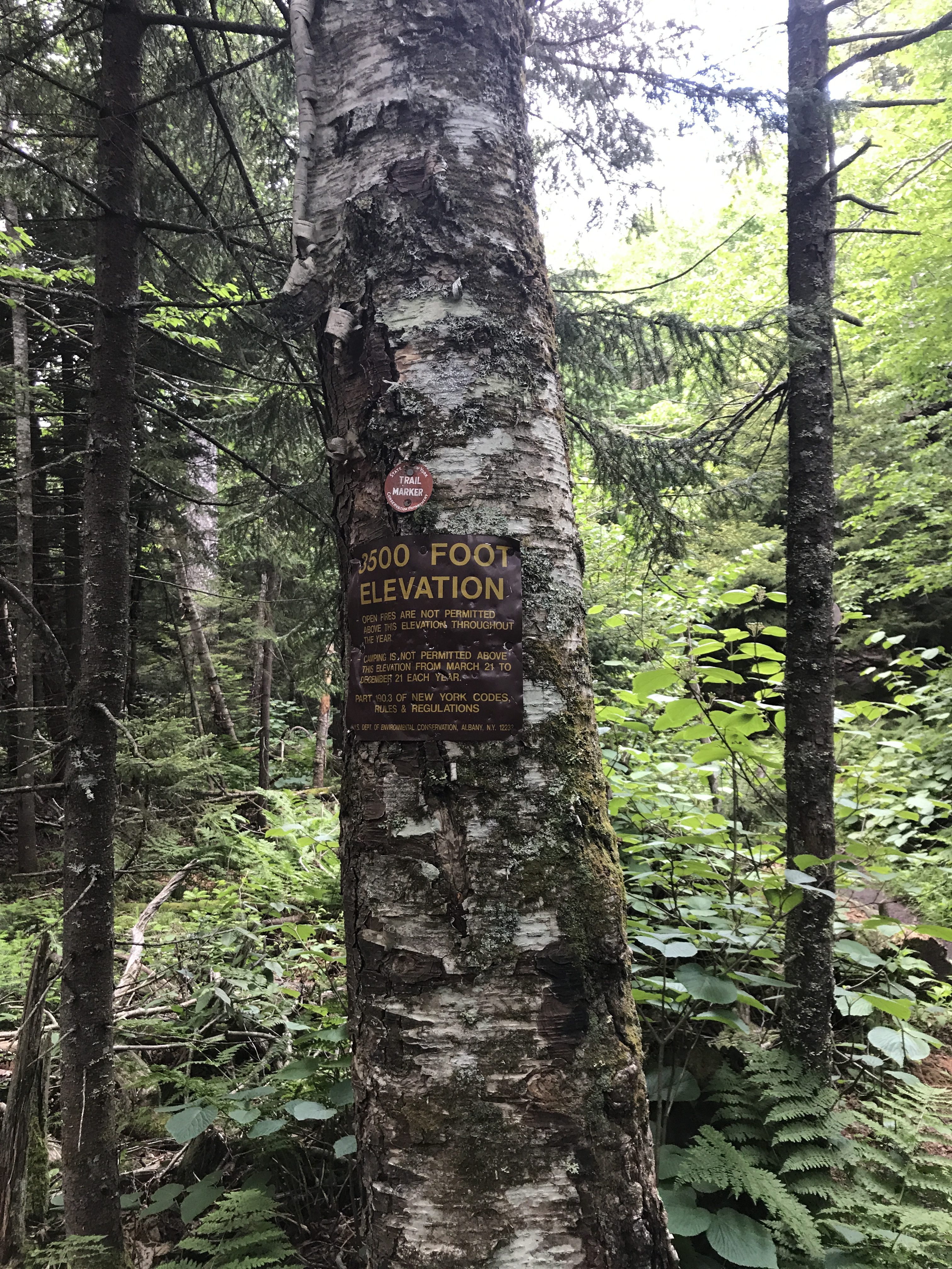
Please remember I am remembering from 8 months ago and we tend to recollect  the best of things, never the worst.  The morning started weird, first with Hector not having the right socks, and us scrounging at the beginning to find an open store.  Thankfully, we were close to a ski town and found a place.   Then, I noticed the spikes and I said, Hector I said these or better.  He said, these will be fine.  They probably could be, for a stroll in an icy park, no to tackle Sugarloaf Mountain, a very difficult hike without the elements, sitting at 3800′ this is not a stroll in the woods.  In this moment, and I did not tell Hector this, or maybe I did, but I thought to myself.  This is a bad idea, this is a bad and ominous start.

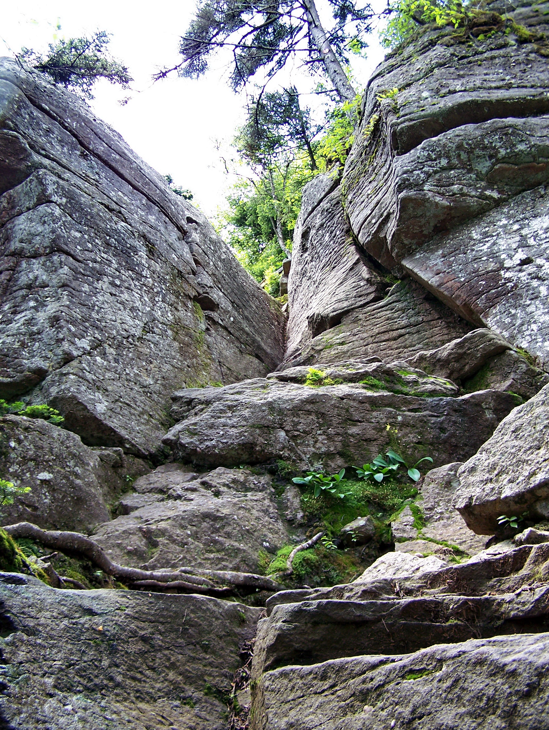
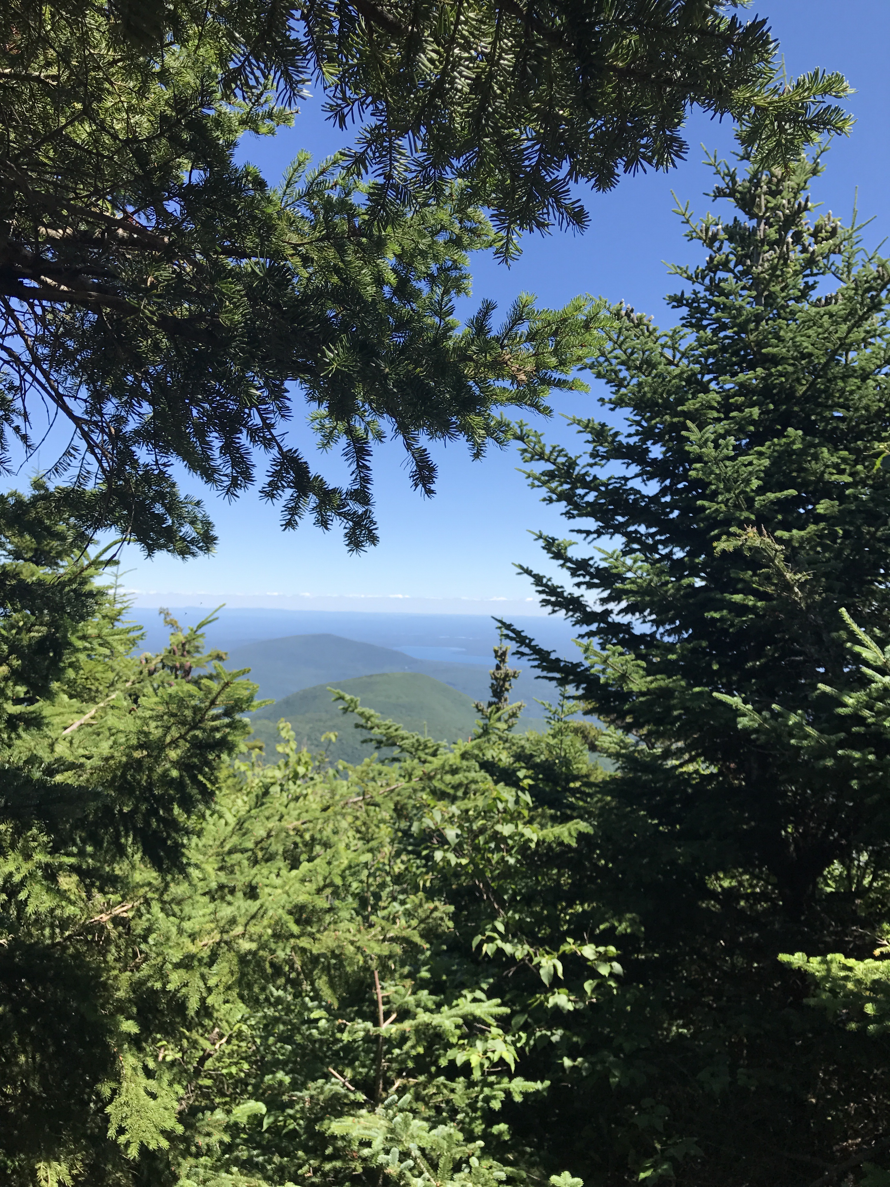
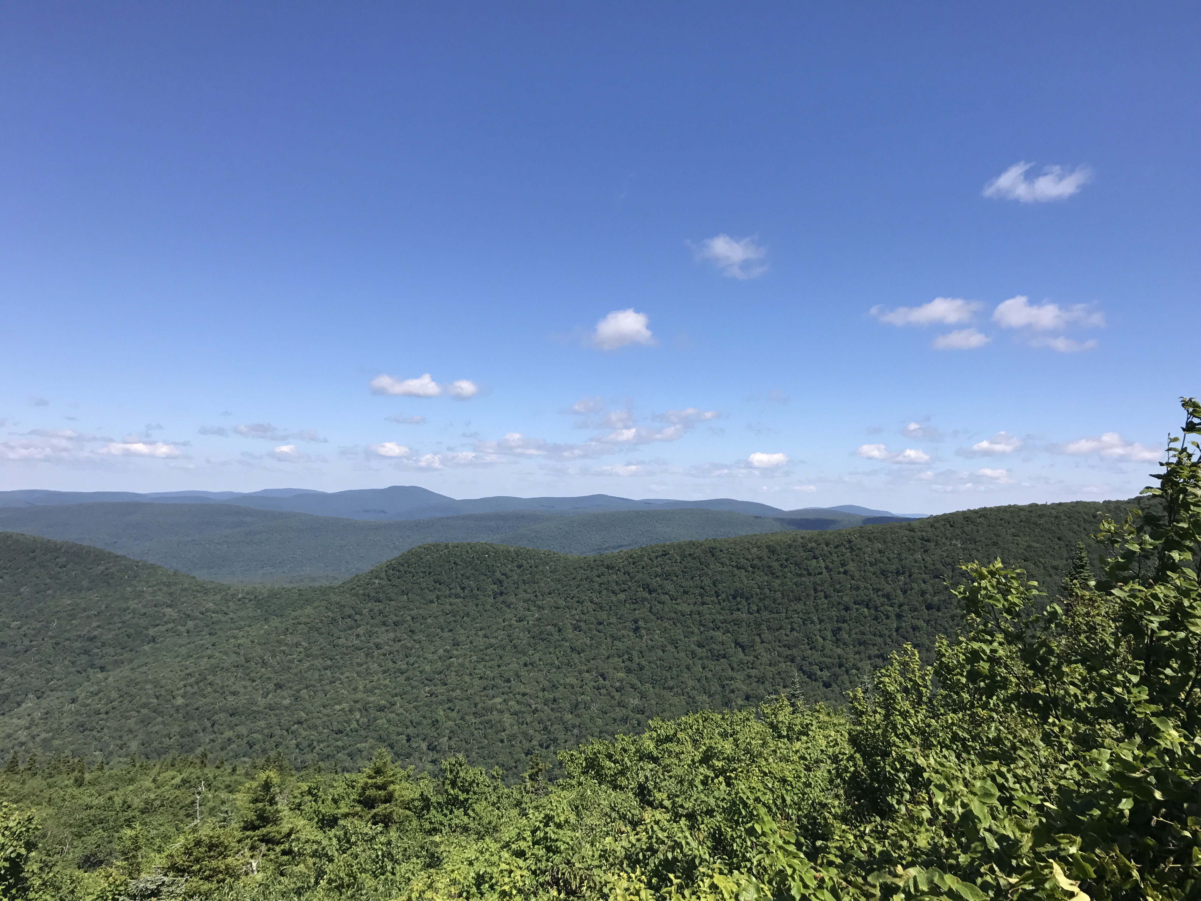
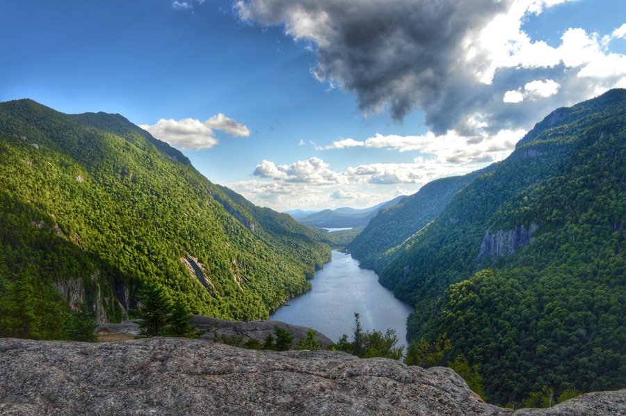
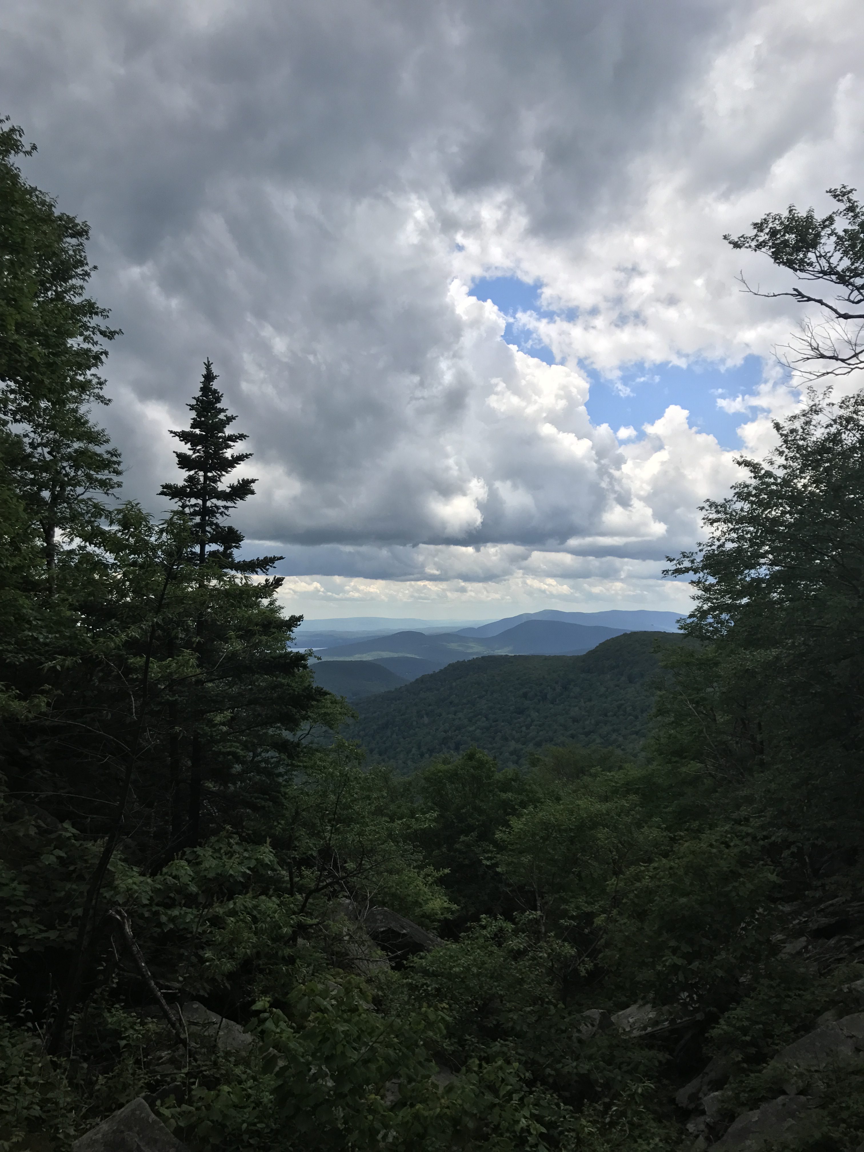
But we headed on, and it looked easy and simple.  Look at the beauty of this beginning:

IMG_1983

It looks simple and welcoming, and Hector looked happy, growling at the mountain he was about to defeat, even if the end left him a bit scarred.

IMG_1982

It did not stay as such.  As we start walking and the snow starts getting deeper and the temperatures slowly start to dip as we climb one of Hector’s spikes is left behind.  The spike literally got caught in the ice and decice to leave Hector’s shoe.  Again not a good sign.  He cannot seem to get a good hang of them on his shoes.  But we keep moving, continually adjusting the maladjusted spikes.

IMG_1990

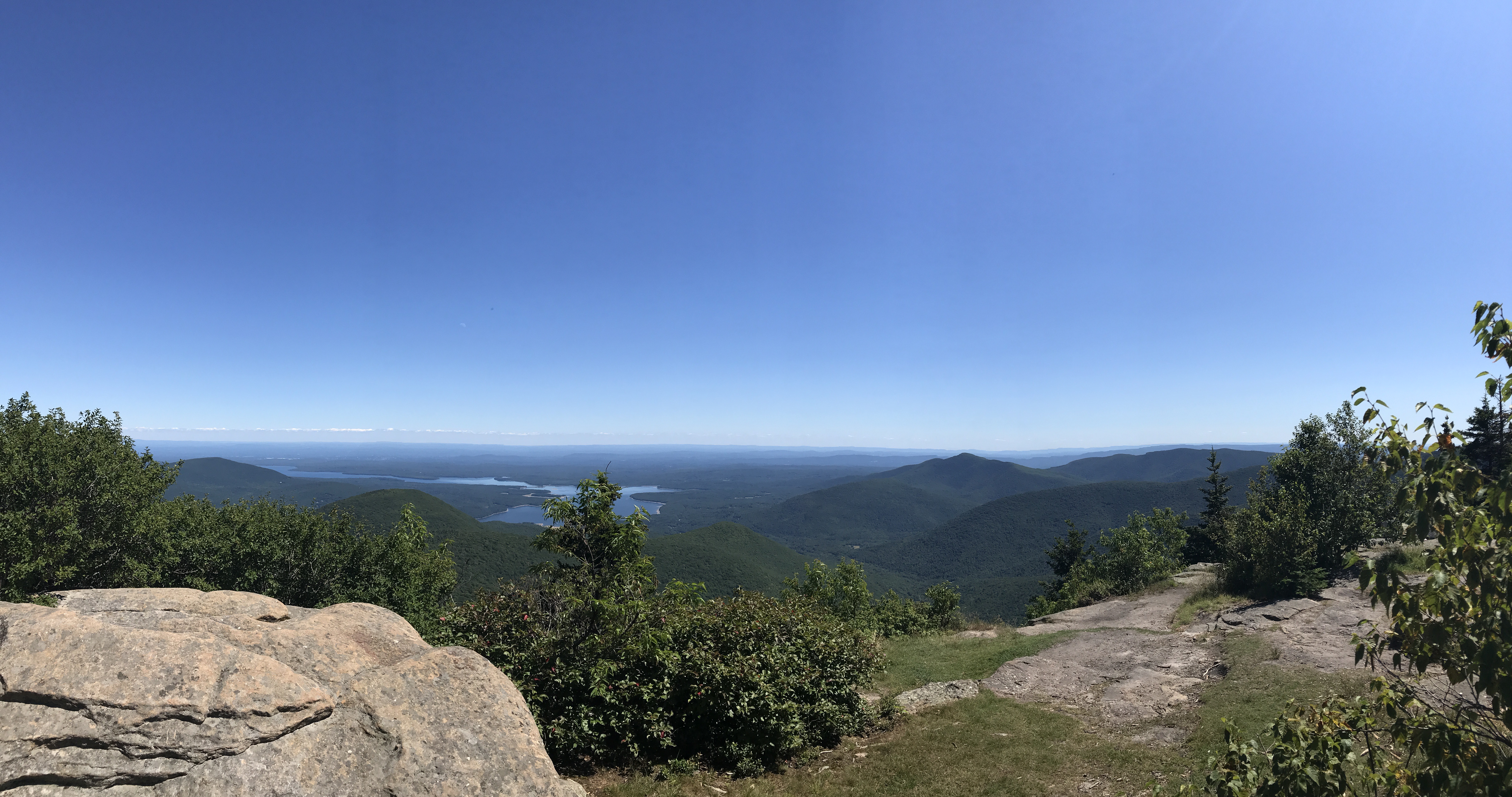
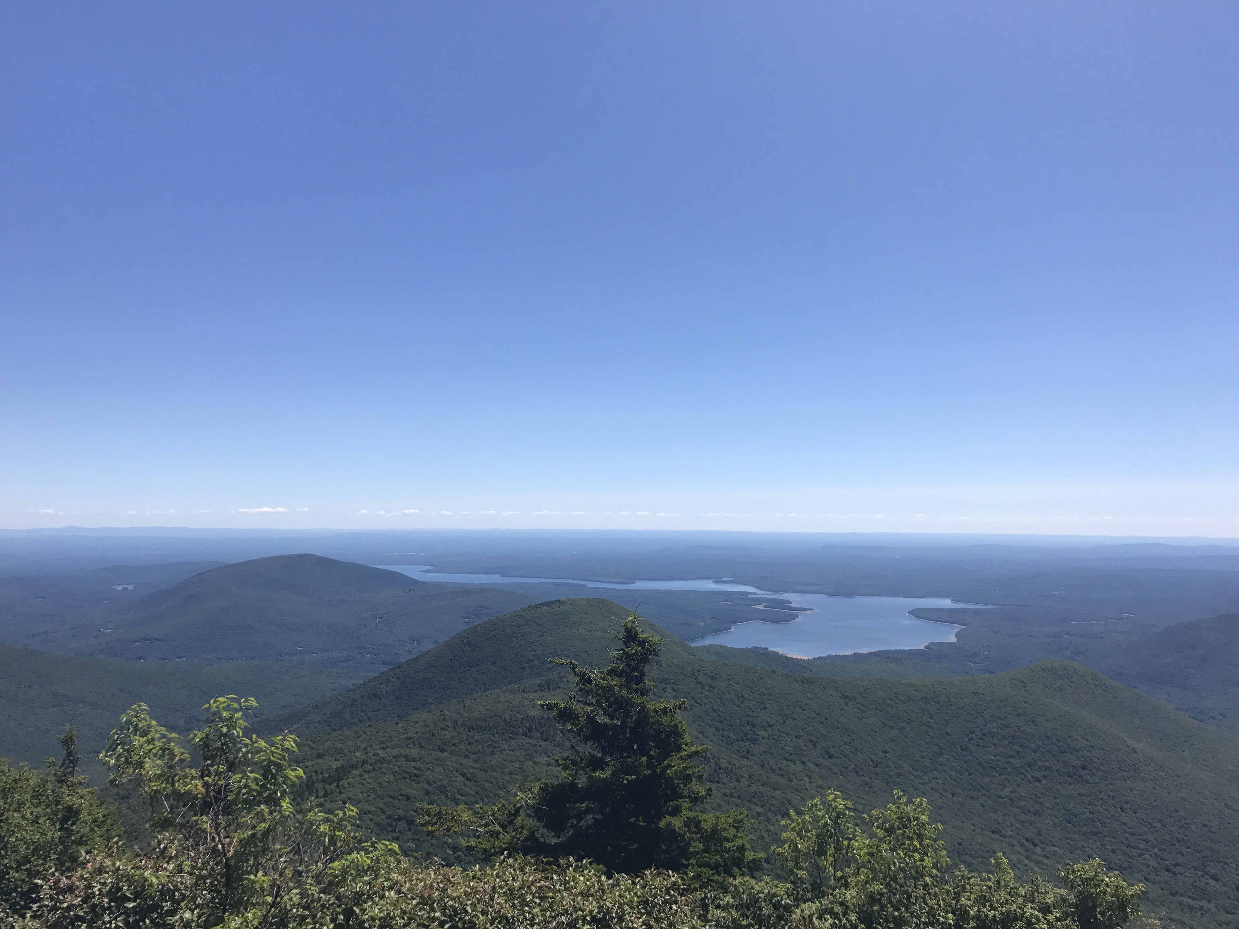
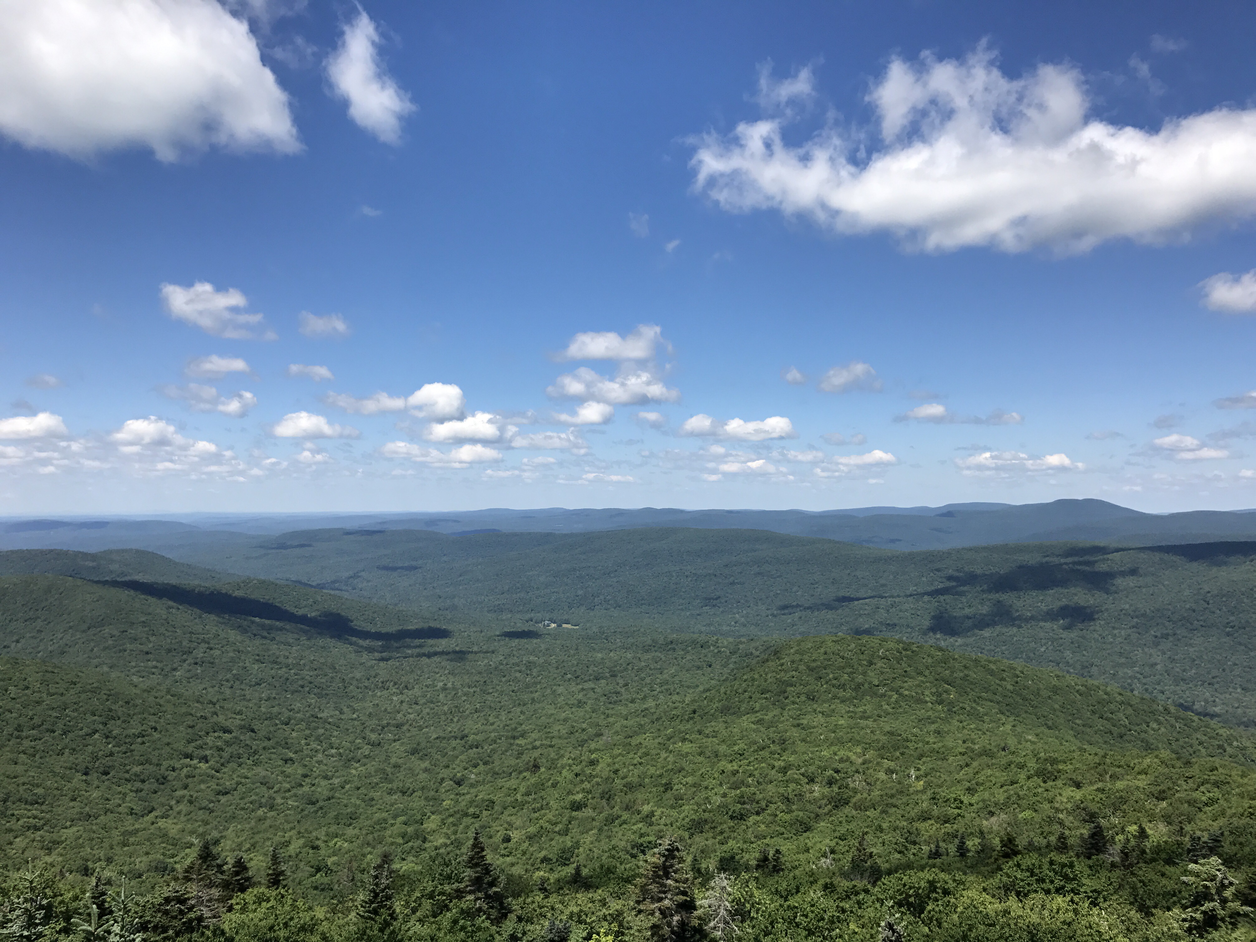
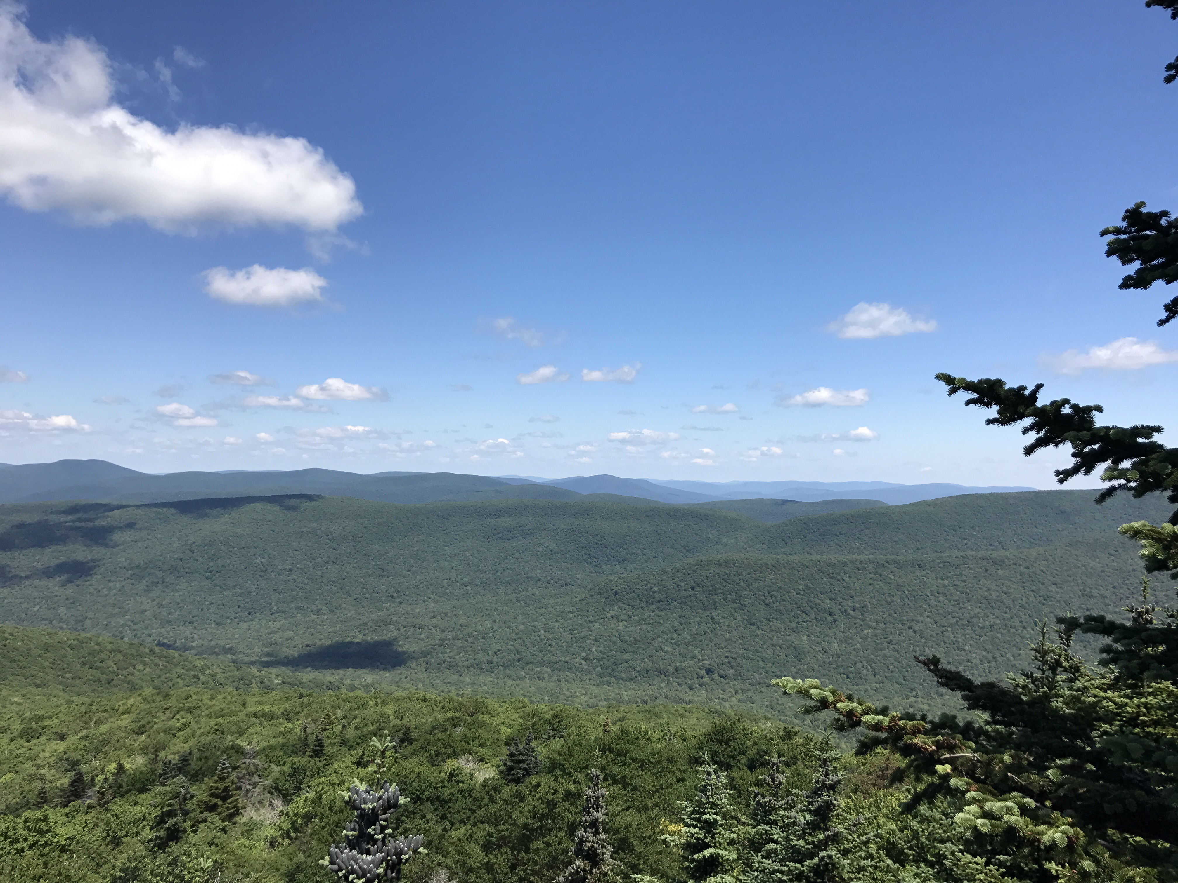
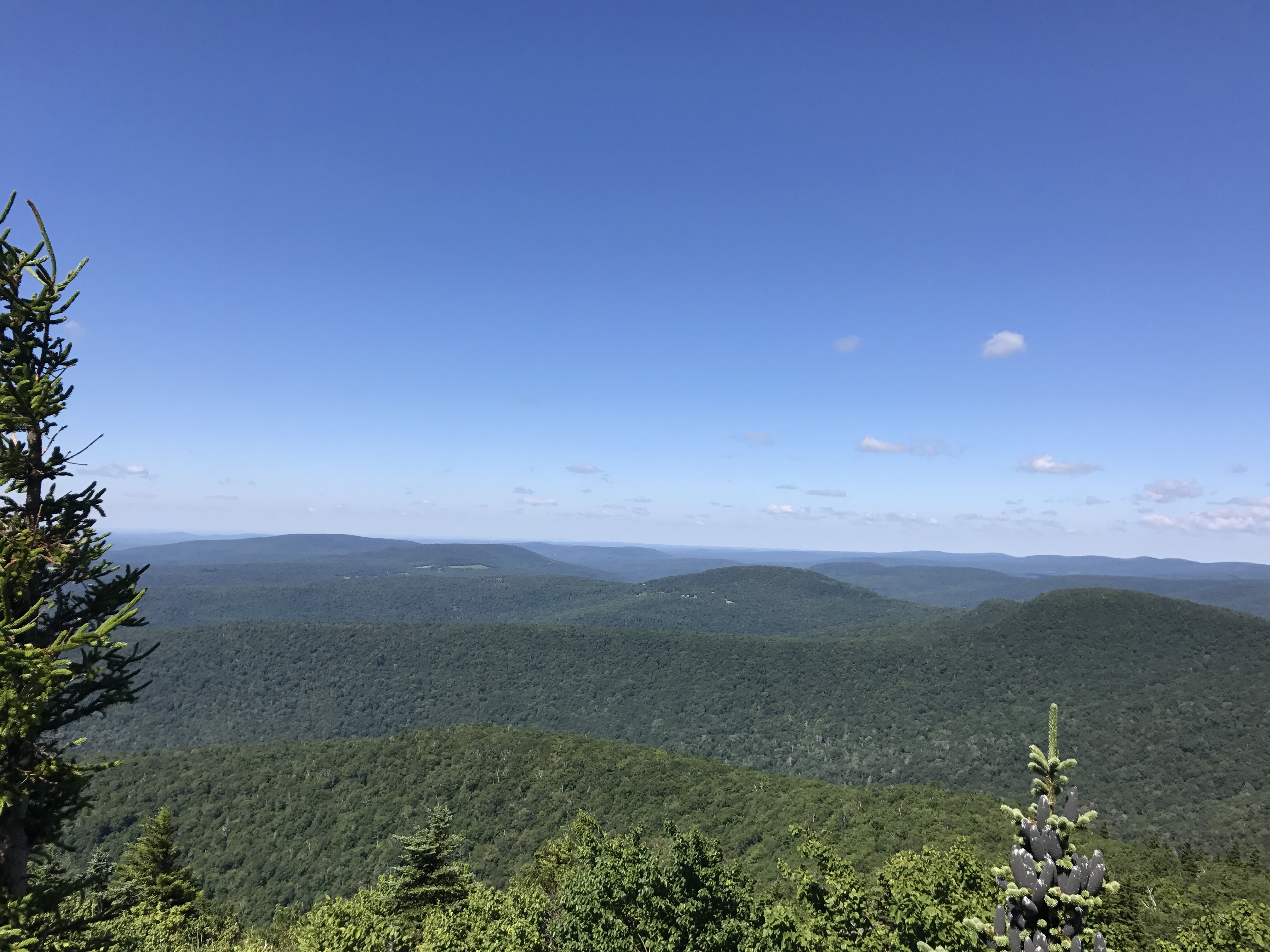
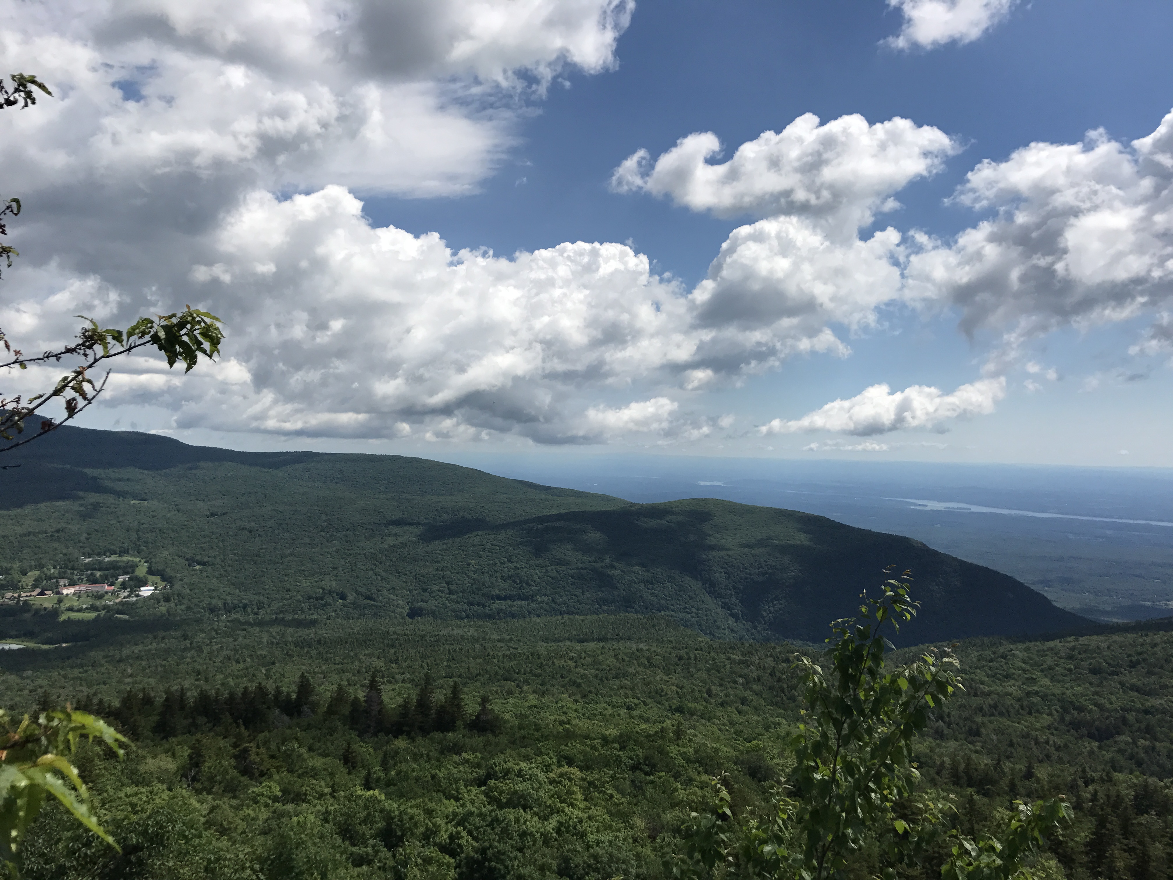
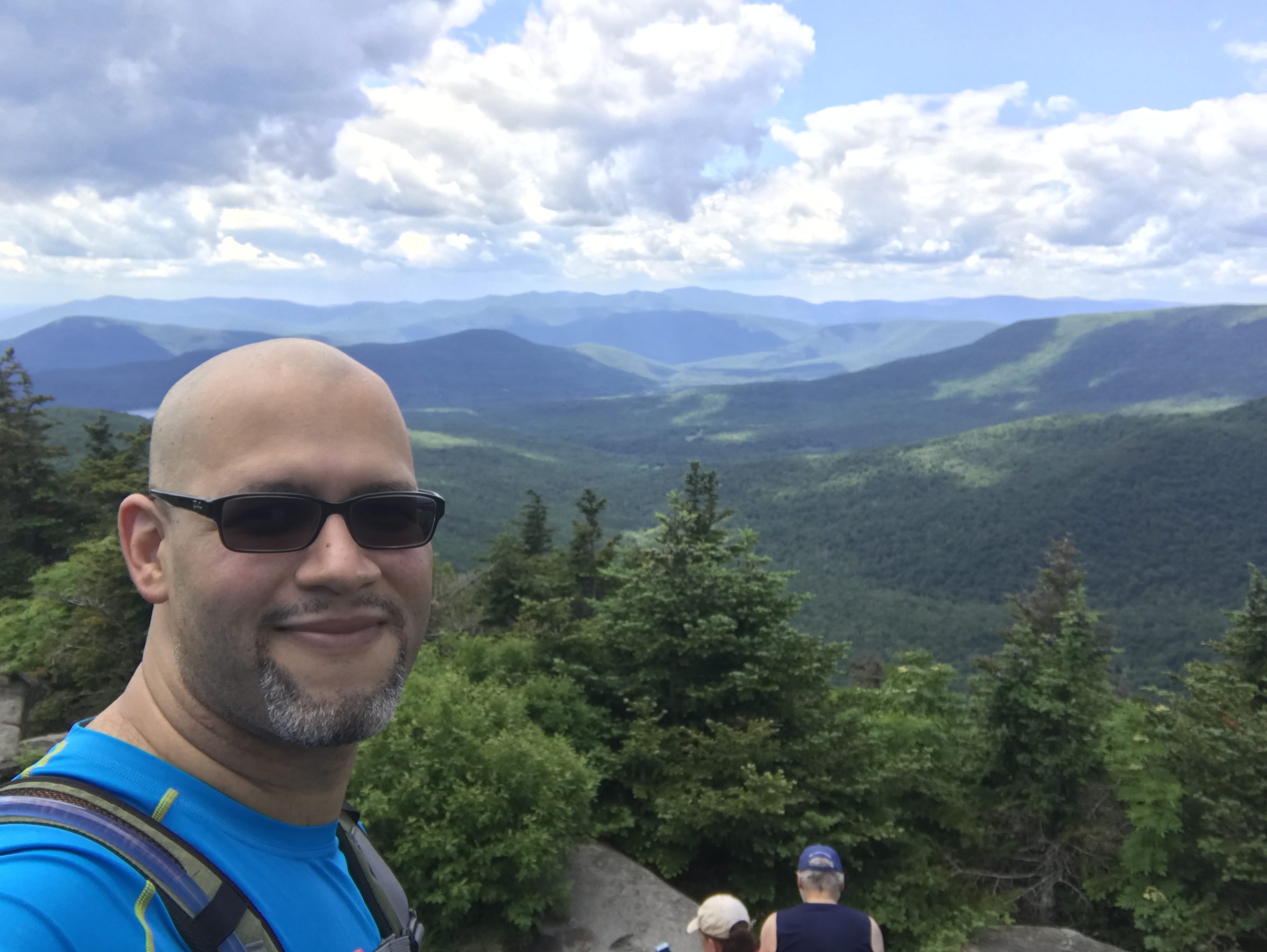
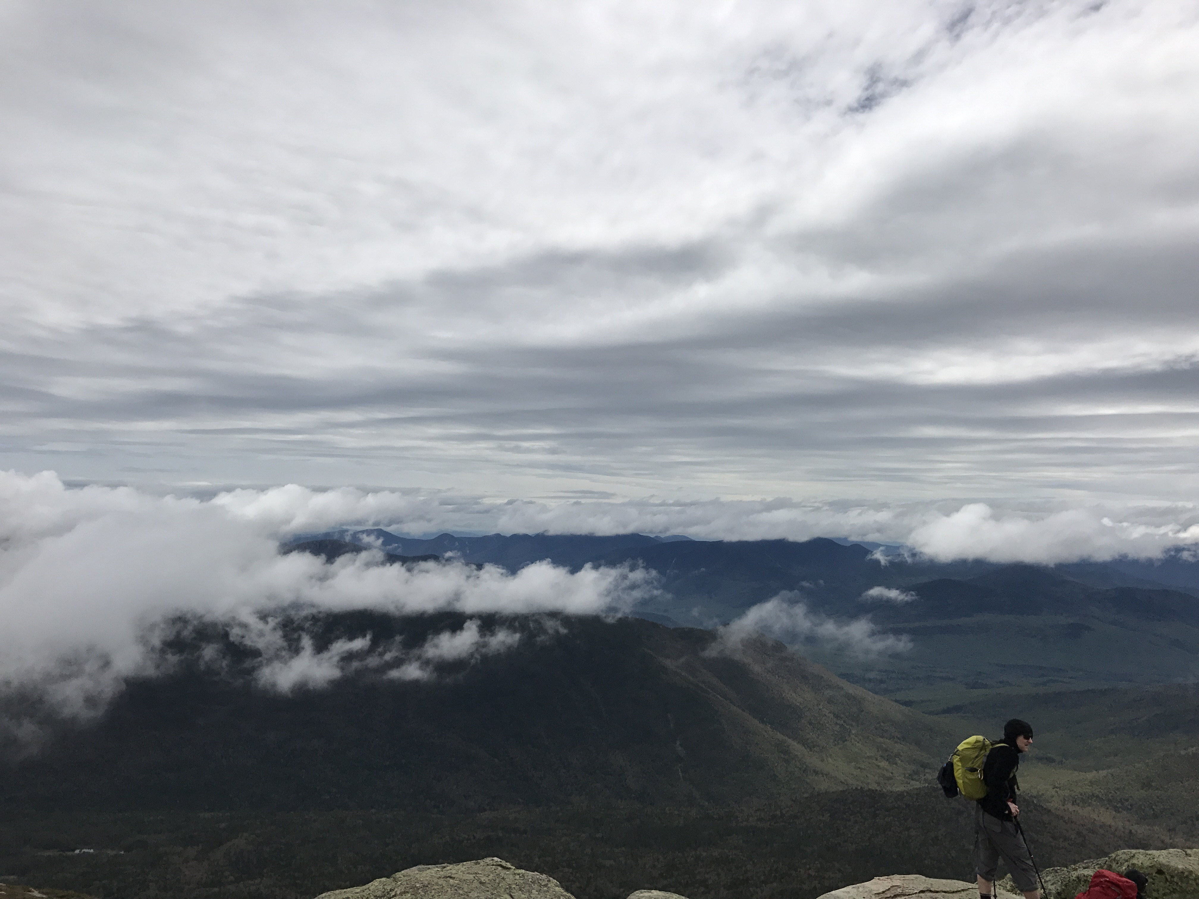
And the climb is difficult but quick, but the climb is not what I fear since what goes up must come down.  The descents are always so much harder than the climbs in this type of weather.  The descent is when sure footing becomes such a critical part and Hector’s spikes have a vendetta against his boots.  Before we discuss the descent though, look at the beauty of the top!

IMG_2017IMG_2035IMG_2016

But then comes the treachery of the descent.  The descent was ICE and more ICE and then more ICE.  Combined with a couple of straight down climbs that are difficult without the sheets of ice.  In this descent down I have seen Hector go past me, not once but twice.  TWICE., to the point where I am grabbing my phone and thinking, fuck, I’m gonna be one of those calls.  What am I to do with this man if he breaks something in one of these falls.  Thank god Hector is built like an OX.

Then we reach the place we spent an hour considering the ideas, plans and circumstances that led us to this point in our lives.  On the side of a mountain on a seemingly 90 degree drop in a thick sheet of ice.  With Hector’s spikes being nothing more than set decorations.  After some crazy ideas that involve jumping from a ledge to a tree and shimmying down.  I tell Hector look, let me get down, cause while treacherous I can see a way down, but it requires sure footing and trusty spikes that can actually grab on.  I say something like,  once I am down, we will have a better vantage point in which to figure out a way down for you.  As I slowly make my way, I hear you know what I’m gonna try this way… Let’s just say when I got down, Hector was next to me, he went the Wile E. Coyote route and jumped from the ledge to the tree.

After this the rest of the way was, let’s just say a slow impending feel of death adventure down a seemingly harmless beautiful mountain intent on killing my friend Hector.
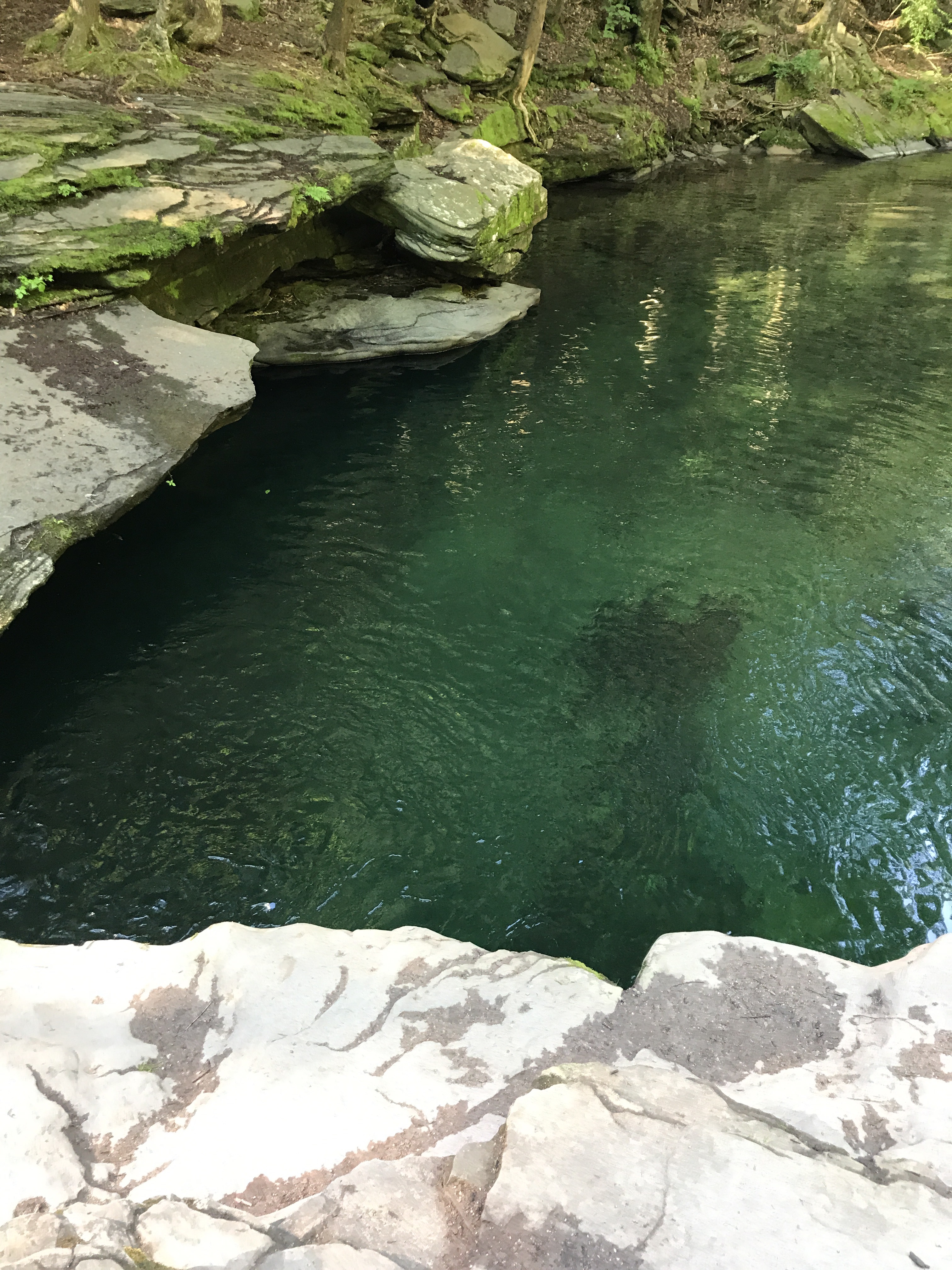
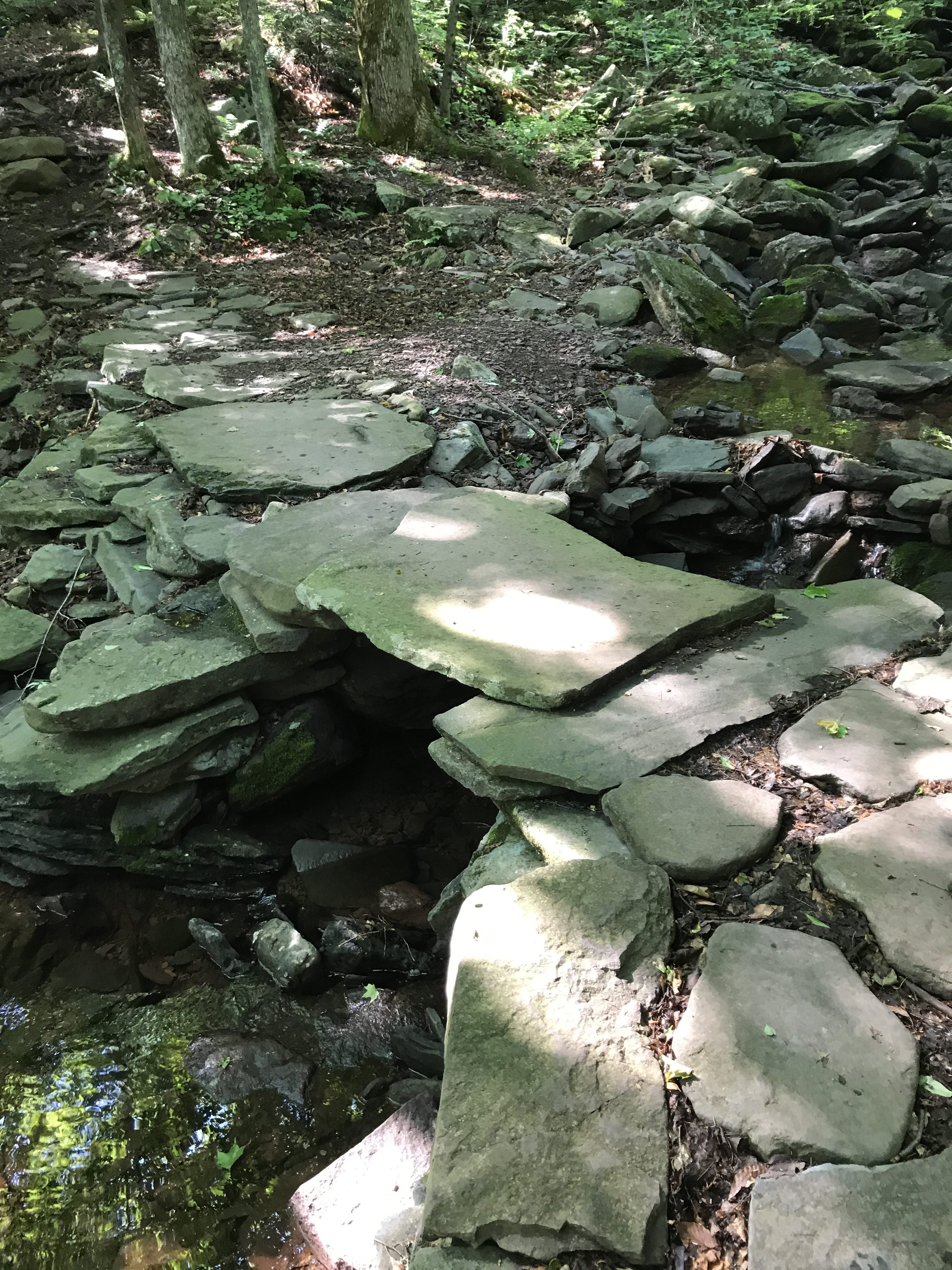
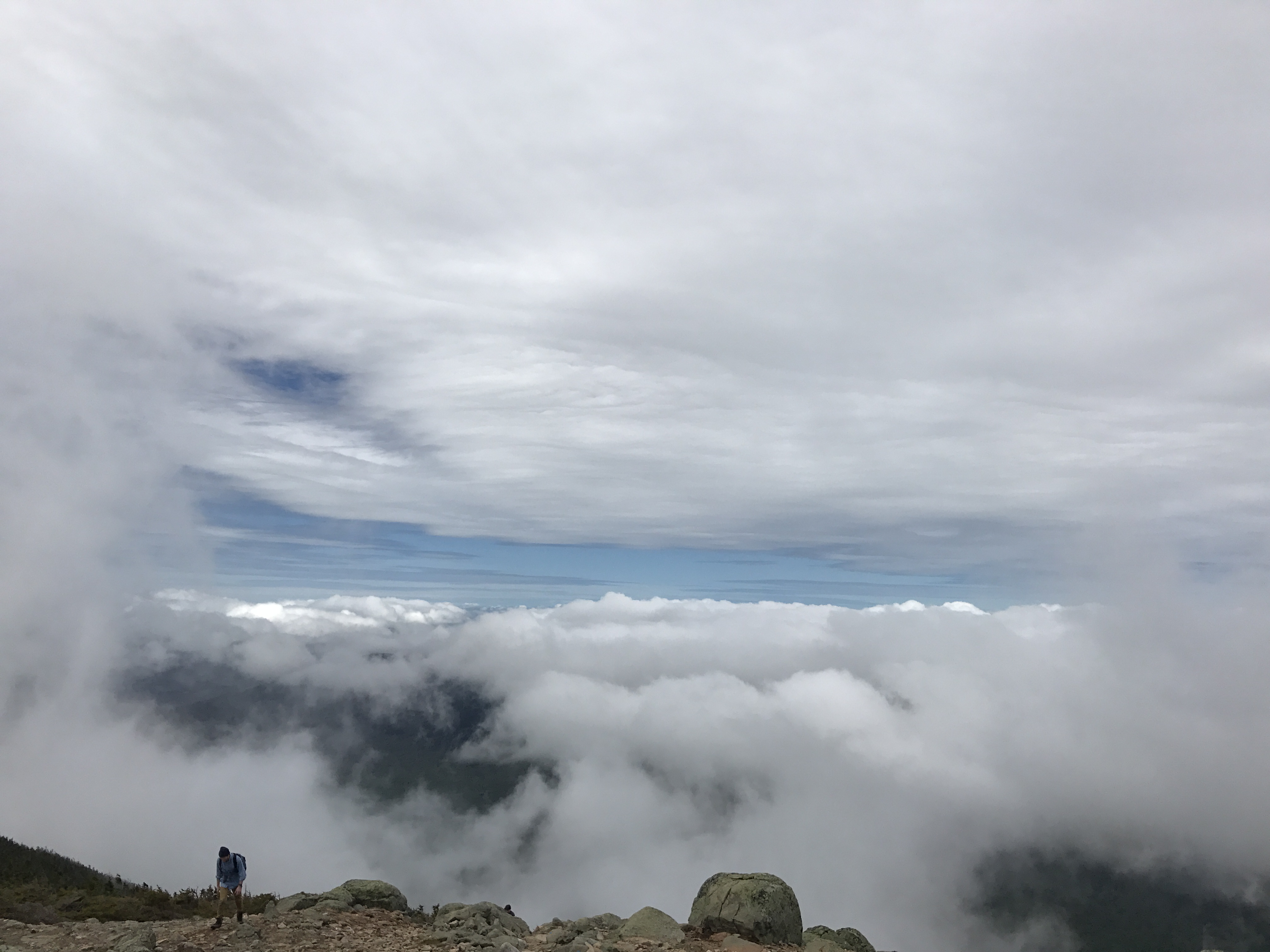
Look ICE:

IMG_2041IMG_2039

The ice is not your friend though…  Sorry about this pic friend:

IMG_2044

Blood is a beautiful motivator to be careful as fuck!

Anyways, we made it down.  The mountain DID NOT KILL HECTOR… Yet oddly enough he wants to tackle that fickle bitch again but with proper gear.  Proper gear is of such paramount importance.  Gear, Layers and pack like if you are gonna get lost and spend the night.

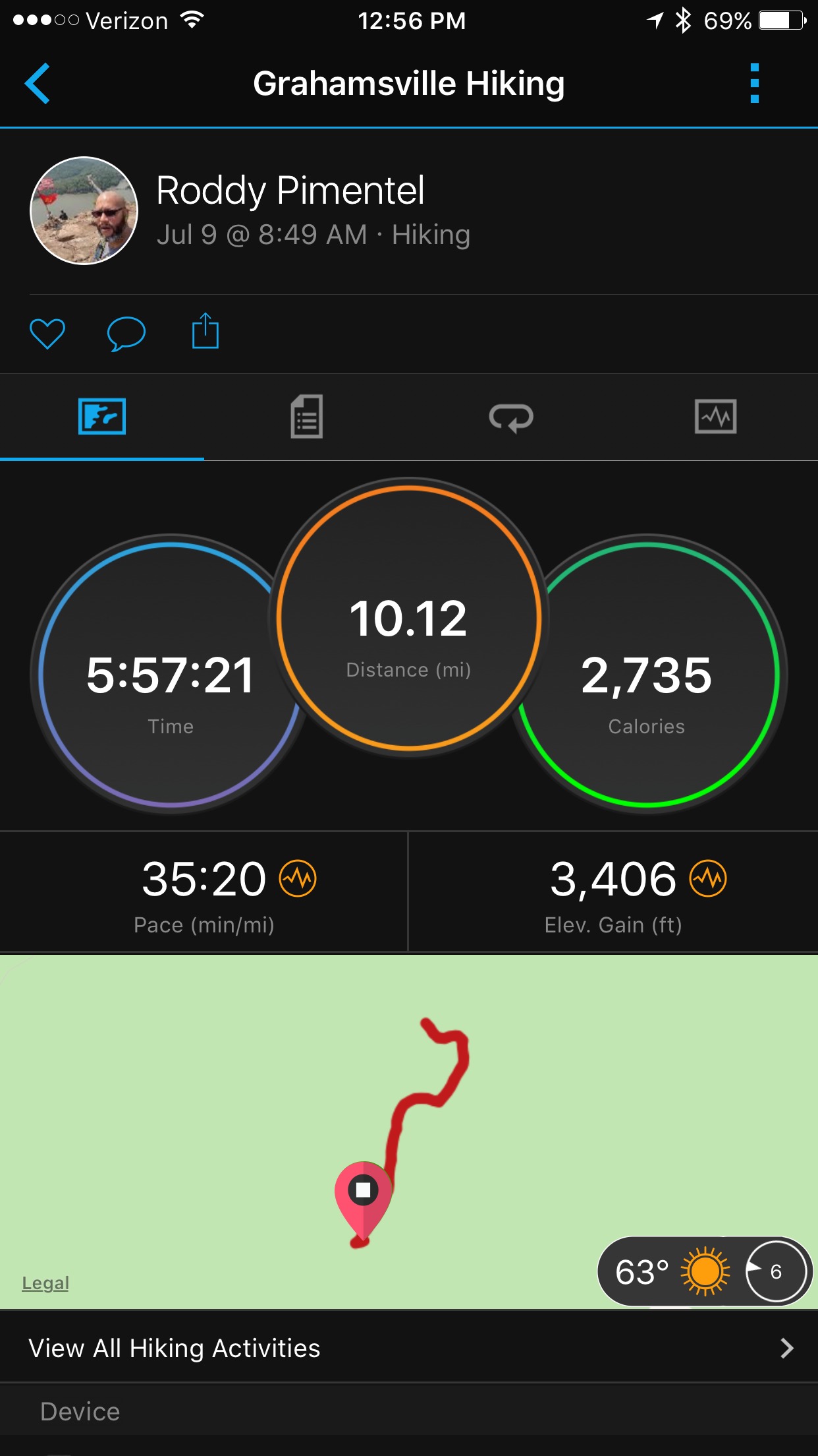
I remember it took us 9 hours for what should have been a 3-4 hour hike.  The burger I had after was among the best of my life.  The beer never tasted so delicious.

Until next time., I will continue my tackling of these Catskill beasts the moment I finish this freaking hell of a marathon.  Until next year when I tackle the last marathon I will ever do, NYC.

See the rest of the pics of Sugarloaf CLICK HERE FOR ICE AND SNOW, BUT NO DEATH


Hunter Mountain – It’s the Climb

Like many people, when I think Hunter Mountain, I think ski slopes.  Unlike other people when I think ski slopes, I do not envision myself swooshing down a mountain.  The simple fact is that Dominicans don’t ski, or at the very least this Dominican will never ski.  The only Dominican I have ever known that ski’ed broke his leg twice doing so.  We are warm blooded and caribbean, it’s just not in our nature.     Hunter Mountain though has the distinction of being the second tallest peak in the Catskills.  There are two different ways to get up to it, a short brutal way and a long not brutal way.  I chose, a short 5 mile up and back route, that was BRUTAL.   Yes, I do feel the need to yell that.

Here’s why.  Up until now most hikes are a combination of climbs followed by a reprieve, then more climbing.  Hunter though, was just climb.  You start off easy enough, with two huge pillars welcoming you into this beautiful mountain.  You start the hike off following a beautiful stream and crossing over a nice wooden bridge followed by a small old dam.  Sounds peachy, right. After the dam though, you climb, you climb until you reach the top with the only reprieve being when you stop to breathe.

On this particular climb, on this particular day, the moment I hit 3500′, the trail turned into an icy and snowy mess.  I was hoping to not bring out the microspikes but, better safe than sorry, when it’s all climb and you run into this:

IMG_0797

IMG_0799

As I climbed in this ice and snow, I asked myself, how the hell is this going to be going down?  Microspikes or not, ice is ice.  I stopped and reconsidered a couple of times, turn around or not.  I persevered though, even if I doubted myself the whole way up.  Sometimes I do idiotic things, but this did not feel like one.  This felt right.

Am I glad I did.  Once you get to the top of Hunter, you are immediately greeted with a huge fire tower, a building and not sure what that was but a semi sitting area.  The wind up here was brutal though, I literally had to hold my phone with two hands at all times in order for it to NOT fly away.  As I climbed the fire tower the wind got worst and worst, at one point I decided I needed to forget about everything else and just at all times when I move, hold on to multiple places.  While the top of the fire tower was locked.  Oh my god, I did not have to get to the top to see these beautiful views.

IMG_0801

IMG_0803

IMG_0804

IMG_0805

The last picture are the slopes for hunter mountain or the ski side of the mountain.  I love how the slopes look like fingers from afar.  At this point though the wind and the cold were killing me.  I mean, it was a cold day to begin with, at 4000+ feet, the wind made it nearly unbearable.  So much so, I almost considered putting on another layer of clothing.  Instead, I departed the top of the mountain and took a roundabout way to get to this amazing little view on the other side of Hunter.

IMG_0824

After the view, I decided to concentrate on coming down the mountain.  The first 500ft of so of descent were ice and snow covered so all my concentration and attention went on footing.  Once I passed the 3500′ mark, I took off my spikes and it was a rapid descent to the bottom.

In the end though, it was a quick 5 mile hike that included two miles of the hardest ascents I have done in the Catskills, not because it was difficult, but because it was incessant.

I left the hike wanting a bit more though, so I opted to stop for a bite at a local restaurant and hit Kaaterskill Falls as a quick 2-3 mile add on.  I attacked it from two places.  I did the new trails that cover the top of the falls and the traditional trails from Haines Falls.

Kaaterskill, even in its dry times is a sight to see, so the whole side trip was worth it just to awe at it.  On a day like today, there were very few people there, so enjoying it in tranquility, without the usual crowds was great.

IMG_0847

“While people are struggling unhappily in the cities against the cruel authorities, a waterfall happily and cheerfully flows in the nature; there is happiness only if there is freedom!” (Mehmet Murat Ildan)

As always, CLICK HERE for the full Album and Videos…

Slide Mountain – Tallest in Catskills

Sometimes you simply need a workout or in my case a mountain to kick your metaphorical arse.  To remove the cobwebs that hinder our thinking and give clarity to a foggy world.  So, when I had to choose what my next mountain would be, I chose Slide Mountain, the tallest mountain in the Catskills, aptly thinking that it would kick my ass in the process.

Let’s get the particulars out of the way first.  Slide Mountain sits at 4190′ making it the tallest mountain in the Catskills.  This is the 7th of the Catskill 3500s I do and even though it was the tallest.  It turned out to be the easiest of the bunch thus far.

When I got to the parking lot that day, I was the only car there. So I would have Slide all to myself, and I did.  Apparently, there use to be a fire tower atop Slide. That would have been a sight back then, a tower atop the tallest mountain.  Alas, it’s no longer there. This meant that after a quick climb the trail was pretty much the fireroad that allowed vehicles to get to said tower.  I opted to make it a little bit more difficult for myself and veered off the fireroad into a trail less traveled.  The fireroad is actually the Cornell/Wittenberg/Slide Red marked trail, I would come down that way later on.  I walked another mile up and took the Blue trail that that affords more of a hike with a couple of great viewpoints along the way.   You also get to see an amazing natural spring, where the water is literally just sipping out of every orifice the mountain has to offer.  The ground in the area is very mushy, and the sound of running water simply reverberates the entire area.  You should definitely see the video.

IMG_2863

The reason to take the blue trail instead of the easier and quicker red trail is to get an actual workout and get the feeling that you are hiking instead of walking up a fireroad.  Also, for the spring mentioned above and two viewpoints not available on the Red Trail aka the fireroad.  The first viewpoint affords some great views of Table Mountain.  You also get to see some amazing colors mainly a reddish hue marking the ever changing foliage of the Catskills as autumn gets into the swing of things.  The second, a clear cut view of Table again, as well as Lone and Rocky Mountains.  Here are those two viewpoints.

IMG_2868

IMG_2874

Eventually, the Blue Trail reconnects with the Red trail and the aforementioned fireroad which will lead us to the Top of Slide.  Before arriving to Slide though, you get to what the NY/NJ Trail Conference says is the best view in the Catskills.  I may have to disagree, but it is quite amazing.  You tell me:

IMG_2882

Another quarter mile or so, and we arrive at the top of Slide Mountain.  At this point the elevation gain was maybe 1800′, yet I was standing at 4190′ above sea level.

After contemplating the height of my being at the moment.  I pushed through past Slide to an overlook another quarter mile ahead.  Here, you get to see Cornell and Wittenberg in the distance with the Ashokan Reservoir just past it.  This is where I decided to sit and rest and enjoy the view while snacking on something.  The video does this point here more justice.

IMG_2888

At this point, I still feel like I needed a work out.  I had only done about 1800′ of elevation gain.  So, I kept going to try and find another natural spring that was suppose to be a half mile past and what a half mile it was.  I started to descend at a pace that was scary, since I knew I would have to climb back up later.  Some points where so steep they put in some really steep stairs to assist.

IMG_2895

If I kept going a couple of more miles on this trail,  I would have gotten to Cornell, followed by Wittenberg.   After hiking close to 3/4’s of a mile without finding the spring, I turned around and climbed what I had just descended.  A total of about 500ft in 3/4’s of a mile.  Talk about a nice workout.  I sat on the ledge right past Slide again and just enjoyed the peaceness of being at this point, at this time, without another soul in sight.  On a side note.  The author John Burroughs apparently introduced the world to slide mountain and he used to come up here to think and write. There is even a plaque in his honor on that ledge.

IMG_2890

The way down was quick and uneventful.  I took the fire road down and the descent was quick and almost a trot.  In the end, the hike did exactly what it was suppose to do.  It gave me a spec of clarity when I most needed it, which is always welcomed.  I have not been back on the mountain for a serious hike since this one and I miss it along with the reflection.  Cuba and random weekends got in the way.  I will get back to it now that the temperatures are dropping and I am done with training for the Queens half marathon.  Nothing better than winter hiking to warm a cold world.

For a full gallery of photos and videos CLICK HERE.

I will end this with three quotes from the guy that found the mountain and used it as a haven to read/write/reflect

“I go to nature to be soothed and healed, and to have my senses put in order” (Burroughs)

“A man can fail many times, but he isn’t a failure until he begins to blame somebody else.” (Burroughs)

“The smallest deed is better than the greatest intention.” (Burroughs)

Wittenberg and Cornell Mountains

I was very excited about Wittenberg, one of my favorite websites HikeTheHudsonValley.com called it the best view in the Catskills but a difficult, difficult climb.  Wittenberg sits at 3780′ and Cornell sits at 3860′.  This is not a simple jaunt that also included the infamous Cornell Crack

Cornell Crack

I started this hike the day after my son’s 14th birthday party which went a bit late, so I was on very little sleep.  The ride to the hike took me alongside Esopus Creek with very picturesque view of the Catskills on my left hand side as I drove.

Arriving at the place, there was a $6 fee for parking but no one in the area to actually charge the money.  If you go in the future, drive up a little further to the office for the park about another quarter mile further up the road.  I wound up paying after the hike, please don’t just park and leave.

The hike started with force and will behind it, as soon as you cut through some of the camping sites you find yourself with a nice wooden bridge crossing this stream:

Stream at the Start!

Towards the end of the hike, the bridge over this stream would be the thing I long to see the most.  The hike really threw a curve at you in its unabating intensity and difficulty .

As you climb, which is intensive and brutal.  I remembered something Hike the Hudson Valley said referencing to his wife “She enjoys a good casual day hike, but the word “casual” should never be applied to a climb of Wittenberg, unless you’re discussing the dress code. (And even then, it should probably be something more like “casual synthetic chic” or “wilderness casual.”)”

One of the things I enjoying the most about the Catskills though are the rock formations similar to the Cornell Crack that pop up here and there along the hike.  Where you simply have to take a step back and ponder how best to tackle them.  As you arrive to the top of Wittenberg you get a sense that something big is coming.  Right along the 2500-2700′ mark you start seeing spots of a view on your left as you ascend.  As you get to the illustrious over 3500′ marker this trail becomes very anti Catskills.  Of all the hikes I have done so far in the Catskills the top of the mountain is usually very wooded, and the only way to know you are reaching the top is your GPS.  This hike was different, as you reach the top you see faint traces of a clearing and the actual summit hits you hard.

Look at this, this is the most beautiful view I have seen in the Catskills to date and I hope many more like it.

Top of Wittenberg Panoramic
Top of Wittenberg Pano 2
Top of Wittenberg

I truly did not want to leave this place.  It was one of the most serene places I have been in a while.   There was a small group there with me, luckily they were almost done and after a bit, I had this piece of heaven on earth all to myself.  I layed down on the ledge and just contemplated it all…

Alas, Cornell Mountain awaited a bit further down.  Just FYI, the best part about continuing to Cornell is the crack.  Once you arrive it will take a few minutes just to orient yourself.  Above I posted a picture from the bottom of the crack.  The amazement of it all, is that once you climb it, you question how the hell will I get down.  Let’s not overthink that though, I obviously made it since I am typing these words.

The top of Cornell was lacking, but only because Wittenberg was so majestic.

As a headed back down, there was another view of the Shokan Reservoir through a set of trees.

Shokan Through the Trees

On the way back, the Cornell Crack stumped me yet again, but I was able to descend it without falling to my eventual death.

Regardless., if you need to do any of the Catskill Hikes, this should be at the top of your list!!!  It was a great workout and the view was just amazing.


Peekamoose and Table Mountains

I think the first four mountains I have officially done have all been done because something about them is known to me.  With the last two, it was because I wanted to do Indian Head in the Adirondacks and settled for the one close to home in the Catskills.  For this weeks iteration, it was Peekamoose Blue Hole, a wonderful swimming hole high up Rondout Creek.  I visited the Blue Hole years ago for the first time on one hot hot hot day.  I think the temperature was mid 90’s when I left home, and upon arriving at the hole an hour later, it was low 70’s, and the water I think was somewhere in the 50’s (I doubt it’s ever higher than that).  It’s like a refreshing dip into a water basin in the freezer.  See the video below.  I hate to start with a PSA, but, what I found at this little piece of heaven was a mess, discarded food containers and beer bottles.  Please take care of the places you visit, if it fit in your car to bring it, it will fit after as well.

Now on to the Mountains.  I got here early and I was literally the only car in the parking lot.  So it was a solitary climb, I started off on the Peekamoose-Table Trail on the Peekamoose side because I wanted to take a dip in that hole at the end of the hike.  This was the wrong plan, but you live and you learn.  I will say more about that later.  The hike started off with no reprieve whatsoever, no easy stroll to start, it just said let’s climb bitches and if you can’t handle this start, then what the hell are you doing here.  Turn around chump, turn around now, you still have time.  Yet, I didn’t listen to the mountain and chugged on.  Like a chump or a champ, I don’t know…

The terrain in this hike was interesting, there were a couple of these maze type events where you are trying to figure out how to traverse the mazes that these rocks seem to form:

Now., when I hike alone I hike with headphones, one on one off if I am listening to a book, and dangling at times if I am listening to music.  I usually don’t pay attention to anything but my surroundings.  I look at the floor and pound away, not a care in the world, occasionally looking up for my markers to tell me I am in the right direction, or look at the offline trail map on my phone to see my elevation or see where I am in correlation with where I want to be.   Walk, Climb, and continuously pound my feet into the ground, every step closer to whatever summit I’m headed for.  Chipping away at elevation as I go along.  That being said, at the start of this hike I was about 1/3 into Stephen King’s IT… Not the right book to be listening to as I climb in the wee hours of the morning all alone.  The day before I also led a group hike for my CrossFit (The North) gym where I detailed my encounters with Black Bears and Snakes on the trails.  I was asked how I managed and the truth was, I don’t think about it.  If it happens, I react when it happens.  Sometimes like a scared little pansy others in a calm and collected manner.  Today I was aware of everything.  Not sure if it was because of IT, or if it was because of the conversation the day before, but I was reacting to every noise and movement in the trees.

At one point, I hear a quick fluttering.  Then I hear it again but closer.  I stop, and I am not ashamed that I was asking myself, what the fuck am I doing here all alone.  I hear the fluttering a third time and see something running STRAIGHT for me, fast too, like WTF am I looking at here?   I see it’s a squirrel and it’s coming right at me.  My only reaction was to jump straight back and clap really really hard.  I mean hard enough that my hands hurt.  My mind must have thought it was a bear, but no cause with a bear you make loud noises and step back in a calm manner.  I literally jumped off my skin and the fucking squirrel just ran in between my legs.  At this point.  All I could do was laugh at myself, at the situation and at the fear.  I actually stopped paying attention at that point and started enjoying my hike a bit more.  I was reaching 3400 feet of elevation at this point and I was really starting to wonder where my money shots were.  The two on the map thus far had been lackluster and nothing to write home about.

This trail has also been poorly marked.  When I got to 3800′, just reaching Peekamoose I realized that I never saw the infamous over 3500′ sign I have seen my last couple of hikes of this magnitude.  As I reached the summit of Peekamoose Mountain I realize that the only way I can really tell is that it has flattened out a bit and my GPS says I’m here.  It took me a bit to find the tiny spur trail that got me to the view point for Peekamoose.

What a view!!! Even though it’s a bit choppy, I think I was trying to catch the experience of me coming out into the spur trail and being blindsided by this amazing view.  Here are a couple of pics:

Top of Peekamoose 1
Top of Peekamoose 2

Now., to quickly descent only to climb again up to Table and just now I saw the first sign of civilization.  My first other hikers a nice couple just out on a stroll.  They seem to have come up probably at the same time as me but from the other direction.  The terrain stays the same.  Heavily wooded with not much to see but the trees and the sliver of a trail.  Sometimes lost in other small spurs but trust me, if you go too long without seeing that wonderful blue marker, stop and orient yourself.

As I got to Table all I can say is meh… Don’t get me wrong, I just mean that as I stand on the summit I see nothing else but the same.  Just a little flatter, and after experiencing that with Peekamoose I was hoping for a bit more.  It just means that this hike was more about the trek up here.  Which was as always both fun and arduous at the same time.   After a little decline, I found a small spur trail off to the left where I got the following view.  It says a lot, when these views are not top notch.  I want to be wao’d  and while this was wao, I guess I’m starting to expect bigger wao’s!

Top of Table 1
Top of Table 2

After Table, I ran into two more hikers and asked about three more interesting things I saw on the map that would add about 1.5 more miles to my hike, along with a decent amount of descent I would have to re-climb.  They told me the lean-to was cool and the spring was just a spring, those two would add another .60 or so.  I did not know what a lean-to was, I figured a point where you could lean from a tree or rock or something.  No though, it was just a hut, similar to the ones you see along the Appalachian at certain points.  A spring which was just that a tiny spring of water coming out of the mountain, had I needed water I would have tried it.  I thought it would look creek like, but it did not, it was just a pipe in the side of the mountain allowing the fresh water to spout out.

Lean-To Actual a la AT
Lean-To Past Table Mt

As you can see not much to write home about!  I did get to see the infamous 3500′ sign, meaning I descended over 300′ for these shots.  Ouch!


Well, now the easiest, hardest part… Coming down the mountain.  In this case down and up a few times since I have to ascend back up to Table.  Descend Table then Ascend Peekamoose again… Ufff…

Anyways, I stopped for lunch on the Peekamoose View Point and now for real, headed down!  It’s easy because it’s no longer strenuous and it becomes more of an art form than anything else.  You are coming down fast, yet your legs are jello and your knees are feeling the brunt of every piece of descent as you take it, which makes it hard as fuck.

As I go down, now I start seeing people.  They all ask me the same thing how much longer to the summit, I ask which one.  I explain there are two and let them know I am not really sure.  I recite how long I have been out here and they can try to figure out the rest on their own, my brain is not working to compute time and distance right now.  I keep trekking down, looking forward to the dip in the blue hole that will take me out of commission for the next week with a terrible cold.

When I arrive at the parking lot it is a different sight I see.  It is no longer pristine! The parking lot is packed to the gills, there are park rangers guiding traffic letting people know they cannot park on the side of the road and guiding them to other lots from 1/4 mile to a 1/2 mile in either direction.   You hear the loudness of a Peekamoose Blue Hole filled with people.  I take off my boots and everything else I don’t need and head down to the hole and quickly jump in.  My body is telling me no, it’s actually yelling it at me.  Yet I think, how can I be here and NOT take a dip, it would be sacrilegious.   So I jump in once and the cold hits my body with the weight of a few tons.  I mean it was a SHOCK and a half.  Yet, I want a video and give my iPhone to one of the watchers, cause few are really swimming.  It’s hard to jump into 50 degree water! They shoot this video!

I get out, grab my towel  and shirt… Leave my Beats wireless headphones for some lucky person to find and give the people around me a PSA.  I talk about the state of the hole and how I hope they are not part of the problem and please tell other people to pick up their crap.

As I hit the winding road back home,  I reflect on the mistake of jumping into that water after having burned close to 3000 calories over almost 6 hours of hiking these two summits… Oh well, it’s all part of the experience I would pay for over the next week.

Next up, Wittenberg Mountain and maybe Cornell…

This hike was actually done on July 9th, but the last two weeks have been the end of my Master’s program so I have been concentrating on rewrites of my thesis, I will try to log my thoughts and rants of the next hikes rather quickly instead of this 2 week delay.  I knew it would be a delay so I recorded myself throughout the hike with my thoughts, the recordings were hilarious, specially the one about the squirrel.  FUCK IT., don’t laugh too hard, here’s my squirrel incident recording right after it happened:

‘Till Wittenberg!  Scheduled for July 30th.

Final Stats – Peekamoose/Table

Tracking the Catskill 3500’s

These are the names and elevations of the Catskill 3500 footers. As I complete them I will make them italic and scratch them off. I have no idea how I will tackle the ones that have no trails, I have never bushwhacked before so it should be interesting to say the least. Time will tell.

  1. SLIDE MOUNTAIN — ELEVATION: 4180′
  2. HUNTER — ELEVATION: 4040′
  3. BLACK DOME — ELEVATION: 3980′
  4. THOMAS COLE — ELEVATION: 3940′
  5. BLACKHEAD — ELEVATION: 3940′
  6. WESTKILL — ELEVATION: 3880′
  7. GRAHAM — ELEVATION: 3868′ (no trail)
  8. DOUBLETOP — ELEVATION: 3860′ (no trail)
  9. CORNELL — ELEVATION: 3860′
  10. TABLE — ELEVATION: 3847′
  11. PEEKAMOOSE — ELEVATION: 3843′
  12. PLATEAU — ELEVATION: 3840′
  13. SUGARLOAF — ELEVATION: 3880′
  14. WITTENBERG — ELEVATION: 3780′
  15. SOUTHWEST HUNTER — ELEVATION: 3740′(no trail)
  16. BALSAM LAKE MOUNTAIN — ELEVATION: 3723′
  17. LONE — ELEVATION: 3721′
  18. PANTHER — ELEVATION: 3720′
  19. BIG INDIAN — ELEVATION: 3700′
  20. FRIDAY — ELEVATION: 3694′ (no trail)
  21. RUSK — ELEVATION: 3680′ (no trail)
  22. KAATERSKILL HIGH PEAK — ELEVATION: 3655′
  23. TWIN — ELEVATION: 3640′
  24. BALSAM CAP — ELEVATION: 3623′ (no trail)
  25. FIR — ELEVATION: 3620′ (no trail)
  26. NORTH DOME — ELEVATION: 3610′ (no trail)
  27. EAGLE — ELEVATION: 3600′
  28. BALSAM — ELEVATION: 3600′
  29. BEARPEN — ELEVATION: 3600′
  30. INDIAN HEAD — ELEVATION: 3573′
  31. SHERRILL — ELEVATION: 3540′ (no trail)
  32. HALCOTT — ELEVATION: 3537′(no trail)
  33. VLY — ELEVATION: 3529′(no trail)
  34. WINDHAM HIGH PEAK — ELEVATION: 3524′
  35. ROCKY — ELEVATION: 3508′

Indian Head and Twin Mountains – My first foray into the Catskills

First of all, the title may be a lie, I have been to the Catskills and done little strolls in search of swimming holes, but I have never done a proper hike in the Catskills, this was my first.  Mind you, my first 3000+ foot hike was just recently in the White Mountains so I am new to this level of altitude.

It was never my plan to do this hike. I originally saw this amazing picture of a place called Indian Head:

Indian Head in the Adirondacks

As it turns out though there are two Indian Heads, one in the Adirondacks and another in the Catskills.  My favorite hiking site, Hike the Hudson Valley, had an Indian Head in its roster but when I went to go check it out, it was the Catskills one.  This past weekend I really wanted to sit on that rock and soak in that view and have my own little moment of zen, but the almost 4 hour drive deterred me, instead I did the closer Indian Head which is the reason I’m writing right now.

So, here I am about to undertake two 3500’+ peaks, not knowing that they are part of a greater number of them that are secretly calling my name.  As always the weather was nippy at the start of the hike and what was suppose to be a gorgeous day started off with many clouds and chilly at the base of the mountain.  It amazes me at times that in the middle of summer, I’m carrying around layers, just in case.  The temperatures shift greatly though the more you climb.  The hike started fairly simple, a stroll in the woods and immediately a beautiful rock bridge.

Stone Bridge – Indian Head

The climb was pretty steady, and never anything that was beyond what I expected.  What I did realize though was that as much as I climbed, the trees never thinned out.  Hiking the whites, you actually get that feeling of reaching the summit, as the trees thin out and you reach the ridge, it’s all nice and rocky not a tree in sight with 360 degree views of your beautiful surrounding.  In the case of the Catskills, it seems like the trees were never gonna give way and they did not.  I hit one perfect view point on the way to Indian Head after a near 90 degree climb where I had to use tree roots as pull up bars, here is where I started to see why this trail is nick named Devil’s Path.

Best View Indian Head

In this pic notice the river in the background, that’s the mighty Hudson as it meanders left and right.  It’s quite a sight to see from this vantage point as it curves and conforms, widens and thins.  Unfortunately, after that I quickly hit the 3500′ marker, I hit a similar marker on the way to both of today’s summits (also saw them as soon as I hit that mark on the Whites):

3500′ – NO CAMPING!

But the top of Indian Head was surrounded by trees., had I not been looking at the GPS and known the spot I was on, I would have never known.  So down I went towards Jimmy Dolan Notch (I  sometimes wonder where they get these weird names from, who the hell is Jimmy Dolan) losing what felt like way too many feet to have to start going back up, but surprisingly when I got to the notch there was a nice little spur trail that gave me this amazing view.  I usually try to avoid these unmarked trails, but the people I was hiking with wanted to geotag something so I had some downtime to take a look.  The shot just calls to you, since its squished between two sets of trees and giving you a view, that although narrow is still, let me just sit here and enjoy.

Great Shot Off The Notch

To the climb again, and again no real respite and no real indication that we were about to crest the peak.  The Devil’s Path was making sure I remembered it.  The best view of Twin Mt was actually shortly before Twin Mt itself as the real summit was still a bit more than half a mile away along a wooded ridge.

Twin Mountain – The First View

I sat here to eat something, where a friendly queen snake decided to keep me company for a while, thank god we were in a stable rock ledge, because when I finally noticed the company I jumped almost high enough for it to be considered another peak.  The one thing that these two peaks have in common is that while there is no flat piece or sense of obviousness that you are at the summit, the few views you do get are just amazing.  It’s rolling mountains as far as the eye can see and not a dash of civilization.  The mountains seemingly call to you, to stare at them and ogle them like a horny 13 year looking at his first crush.  After eating I was off again, a bit over a half mile to the true summit, have to reach the true summit or what’s the whole point, I console myself knowing that I will double back and I will stand here again and enjoy the mountains that remind me of home.

Twin Mountain like Indian Head was in itself meh, it was the hike that and the viewpoints along the way that mattered.

Twin Mountain

That’s the entire view from a small ledge on the summit.  Whereas from the previous point you got 180 degrees of goodness, vs the bare 90 degrees here.  It was time to double back, and start a mad descent losing every foot I’ve climbed in a shot.  But first I stop at the previous view where I bump into some great hikers. They tell me a bit about the Devil’s Path, how it’s one of the most difficult in the North East, how there is a great site with all the 3500 footers and how there is a group of people that try to complete them all.  Right then and there, I knew where every spare weekend day this summer would be spent.  On the Catskill’s conquering all 35 of the 3500 footers, even the ones with no trails at all of which there are a couple.

I hope you enjoy my journey since part of it will be writing afterwards, if nothing else for my own piece of mind, and my own bit a self therapy.

Tackling all the Catskill 3500 Peaks

For the past two years hiking has become my own version of personal therapy.  Whether I do a hike alone or in a group, every step gets me closer to self healing and awareness.  Up until a month or so ago I limited myself to the hikes in and around the Lower Hudson Valley.  We all know them, you have SugarLoaf, Bull Hill, Anthony’s Nose, Storm King, various different sections of the Appalachian (Cat’s Rock, Fahnestock, Depot Hill),  and the list goes on.  Actually, if you take a look at the Hike the Hudson Valley site, I was pretty much trying to tackle all of those specific hikes.  Then 2 months ago I did a 4000′ peak and two 5000′ foot peaks in the White Mountains of New Hampshire.  I honestly loved it, it took me 6 hours or so with a group of friends and all I can say it’s oh my god.

We did:

Little Haystack Mountain, this is definitely NOT aptly named, we went up the Falling Waters Trail which was amazing.  Here is a shot from the top of that peak.  We started the hike on a very cloudy day and as we got close to the peak and the trees started to dissipate, it felt as if I was crossing the clouds to get to the peak.  Almost like crossing over to the top of the world.  Sitting at the top looking down you see the sky starting to break and a hiker about to crest peak.

Top of Little Haystack

At that point, I was hooked, sitting there after climbing 3000+ feet to get to it was mind changing. That peak quickly gave way to Mt Lincoln as we walked along the ridge. Walking along that ridge was a sublime experience, even though the day was cloudy, every where you look it felt like you were above it all.  Like there was no other place you wanted to be at that moment than on that mountain with my thighs throbbing, my glasses fogging and the next peak visible and seaming oh so close, but being way too far.

Here’s a shot from Mt Lincoln:

Top of Mt Lincoln

Finally we continued on Franconia Ridge until we hit the last of the peaks in Mount Lafayette.  Arriving at Lafayette felt like an unreal accomplishment.  I can see why there are many people that just do one of the two outer peaks and just turns around.  At this point, my legs were jello with the prospects of still having to drop over 3000ft in less than 3 miles.  With the only driving force being able to tell myself I did it, and hoping upon hoping that the shack on the way down was open and they had hot cocoa.

Top of Lafayette Group
Top of Lafayette Alone

I came back from that hike with the hunger to tackle something similar but closer to home.  I was gonna head out to the Adirondacks and even scheduled it and then said fuck it and headed to the Catskills to do Indian Head and Twin Mountains, little did I know that they were part of a major system.

Next up, a write up of those two great mountains and how I’m now convinced I will tackle all 35 3500 footers in the Catskills as detailed in this list: Catskill 3500 Peaks!!!